


Rio Arriba County Precinct 29, Rio Arriba County, New Mexico
About
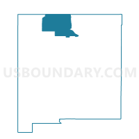
Outline

Summary
| Unique Area Identifier | 623862 |
| Name | Rio Arriba County Precinct 29 |
| County | Rio Arriba County |
| State | New Mexico |
| Area (square miles) | 569.29 |
| Land Area (square miles) | 569.05 |
| Water Area (square miles) | 0.24 |
| % of Land Area | 99.96 |
| % of Water Area | 0.04 |
| Latitude of the Internal Point | 36.39850930 |
| Longtitude of the Internal Point | -107.44814960 |
Maps


Graphs
Select a template below for downloading or customizing gragh for Rio Arriba County Precinct 29, Rio Arriba County, New Mexico


Neighbors
Neighoring Voting District (by Name) Neighboring Voting District on the Map
- Rio Arriba County Precinct 24, Rio Arriba County, NM
- Rio Arriba County Precinct 25, Rio Arriba County, NM
- San Juan County Precinct 15, San Juan County, NM
- San Juan County Precinct 16, San Juan County, NM
- San Juan County Precinct 71, San Juan County, NM
- San Juan County Precinct 72, San Juan County, NM
- Sandoval County Precinct 24, Sandoval County, NM
Top 10 Neighboring County Subdivision (by Population) Neighboring County Subdivision on the Map
- Bloomfield CCD, San Juan County, NM (17,790)
- Napi Headquarters CCD, San Juan County, NM (7,185)
- Cuba CCD, Sandoval County, NM (4,986)
- Jicarilla Apache CCD, Rio Arriba County, NM (3,228)
- Coyote CCD, Rio Arriba County, NM (1,288)
- West Rio Arriba CCD, Rio Arriba County, NM (271)
Top 10 Neighboring Unified School District (by Population) Neighboring Unified School District on the Map
- Bloomfield Municipal Schools, NM (17,928)
- Cuba Independent Schools, NM (4,584)
- Dulce Independent Schools, NM (3,460)
- Jemez Mountain Public Schools, NM (1,510)
Top 10 Neighboring State Legislative District Lower Chamber (by Population) Neighboring State Legislative District Lower Chamber on the Map
- State House District 3, NM (31,169)
- State House District 69, NM (26,984)
- State House District 65, NM (26,930)
- State House District 41, NM (23,742)
Top 10 Neighboring State Legislative District Upper Chamber (by Population) Neighboring State Legislative District Upper Chamber on the Map
- State Senate District 22, NM (60,988)
- State Senate District 2, NM (53,101)
- State Senate District 3, NM (41,208)
Top 10 Neighboring 111th Congressional District (by Population) Neighboring 111th Congressional District on the Map
Top 10 Neighboring Census Tract (by Population) Neighboring Census Tract on the Map
- Census Tract 9432.01, San Juan County, NM (5,702)
- Census Tract 5, Rio Arriba County, NM (3,711)
- Census Tract 9410, Rio Arriba County, NM (3,499)
- Census Tract 9409, Sandoval County, NM (2,668)
- Census Tract 7.02, San Juan County, NM (1,232)